Thursday, March 22, 2018

Hiking to the Bottom of the Ocean

My view of the Coyote Mountains may be one of my all time favorites, and I love hiking in them, but this was the first time I've actually hiked up the mountains.


I knew going in this was a bit of a stretch for me- I tend to be one of those people who needs to slowly adjust to altitude, and I haven't been hiking much in the last year or so.  But I'd never done the famous hike to the bottom of the ocean before and the first day of Spring seemed like a good time to give it a try. I admit, by the time I got back down to the car my legs were pretty tired, but I wasn't nearly as wiped as I had expected to be- and the day after I was still capable of walking, so that seems like a win to me!
Unbeatable view of Imperial Valley


Trace fossils from when this was the bottom of the ocean
 When I'm out hiking, I always try to read up on some of the geology of the area I'll be in and while I almost never remember more than 1% of what I read before any given hike, even that little bit of information I manage to retain increases my appreciation for what I see along the way.   Hiking up the Coyote Mountains, for instance, you are going back 4-10 million years in time, and if you look (one of my excuses for always being slow) you can find amazing evidence remaining that 10 million years ago this entire part of California was a part of the ocean.  When kids come to the museum asking what dinosaurs we had here, we talk about whales, sharks, coral, and oysters.


The entire hike I marveled at the views: the rocks around me, the trace fossils of so many different shells, the fresh scat as evidence that bighorn sheep had recently passed this way- not to mention the breathtaking view of the valley when I turned and looked behind me.  It was a great reminder of why it is so important to get outside some days.  I was not only enjoying nature on a lovely first day of spring (and feeling sorry for my friends and family on the East Coast dealing with their fourth nor'easter in two weeks) but renewing my enthusiasm for the incredible history and geology of the area, and why I encourage visitors to the museum to go take a hike!


Thursday, September 21, 2017

Next Step: Publishing

Getting the book on geoglyphs published will be my first publication available in bookstores, museums gift shops, and online- a lasting work that I hope will inspire a whole new generation of archaeologists, ethnographic research, and interest in the desert Southwest and the people who have lived there for thousands of years.  I'm working not only with Harry Casey, the photographer and author of the manuscript, but with Sunbelt Publications.

Sunbelt Publications produces "well-crafted, award-winning books" that "celebrate the relationship of the land and its people."  Their books help "to discover and conserve the natural, historical and cultural heritage of unique regions" and focus on California, the Southwest, and Baja California, Mexico.

What does that mean? It means I'm very lucky that they are interested in working with me to get this book published!

Now that the manuscript is ready, the photographs have been digitized, all that's left is to raise the money for publishing.  The entire process will cost $10,600.  I need to have the first half ($5,300) to Sunbelt by October 30.

So as a true 21st century, social media answer, I've started a GOFUNDME campaign! Any help you can give is amazing, whether that's donations or sharing the campaign with others who can help. Anyone who donates will be thanked in the book
Part of the famous 'Blythe Giants' complex 

Thank you all for your support as I work to make this dream a reality!

Monday, September 18, 2017

Project Completed! For now

Archiving, accessioning to PastPerfect, digitizing, & encapsulating photos and slides

It's hard to believe it's nearly the end of September already.  A month ago I began an intense digitization project at the Imperial Valley Desert Museum with the goal of scanning all photographs in the Harry Casey Collection that connected to geoglyphs.  In a collection of more than 8,000 individual images, I knew the bulk of them pertained to geoglyphs, but what did that mean? All 8,000? 7,000?


30 days, 230.5 hours, and 2 scanners later, the answer is 4,462.  That's the number of photographs scanned, although there were over 1,000 duplicate copies of individual images.


2 scanners worked hard on this project!
What's next? What was the point of becoming the Mad Scanner? I'll be working with photographer Harry Casey and Sunbelt Publications to put together Harry's manuscript with accompanying images for publication.  The museum will apply for grants to create an interactive digital exhibit based on the work.  After that? There are plenty more ideas waiting to be implemented- not to mention almost another 4,000 photographs of rock art, Nazca Lines, and desert plants waiting to be scanned and create exciting, interesting, and beautiful exhibits!


A special thanks to Dr. David Breeckner, Angelina Coble, and Marcie Rodriguez for all their help with this project!


Marcie examines a slide

Thursday, August 31, 2017

Spot the Difference

Before coming back out to the desert I had assumed I would be working on the whole project by myself.  Very few volunteers want to drive out 30 miles or more to help deal with pictures for hours at a time.  And those who do, tend to spend summers away from the over 115 degrees that passes for normal weather in the Imperial Valley.  But I forgot: the very weather that keeps regular volunteers vacationing also means less traffic at the museum- making it slightly more likely that I could poach staff helpers for the project. They are getting something out of it too- practice with digitizing as well as added familiarity with PastPerfect and the collection.

A week into my large scale digitization project and I've got my co-workers (aka "volunteers") already pretty well trained.  Each geoglyph site gets all the pictures connected to that site laid out over several tables.  I've done a first run through on matching doubles of images but here it's a case of the more eyes (sometimes fresher than mine!) the better.  Once the images are sorted any slides are compared to the printed photos to see if there are any matches.  If so, they go together. If not, they stand alone.  My colleague Dr. David Breeckner compared it to the game "Spot the Difference" you see in the newspaper.  Two pictures are identical at first glance, but can you find the differences?

Dr. David Breeckner comparing images of a geoglyph site
Once the images are ready they are labelled with permanent Accession Numbers (AN) instead of the temporary ones they currently have.  Records are made for the PastPerfect database, images are scanned, then encapsulated, and placed in the newly labelled folders that will be their permanent home.

I know what you're thinking: if ever an archives project called for More Product Less Process, this sounds like the one!  Sadly, that's not entirely true.  The point of my particular month-long project is to digitize images for a book I'm editing for photographer Harry Casey.  One of the main points of interest for the book is not only the images, but the dates.  Casey photographed the same sites over a span of about 35 years and seeing the changes (both natural and man-made) to the sites over time is important (both for the book and for future researchers). As almost none of the printed images have dates on them, the slides (which almost all DO have dates) are essential.  Records with those dates, images and corresponding AN are a must.  So they might as well all happen at the same time.  Although I do admit that in the interest of time I'm not going into huge detail on the PastPerfect records- a future researcher can add notes to them past what I'm doing.
Marcie Rodriguez comparing slides and prints for the same image

We are becoming an increasingly well oiled machine, more efficient each day. As everyone sees what the process is, different volunteers take on different steps to make the process smoother instead of getting in each other's way.  So a big "Thank you!" to IVDM staff Marcie Rodriguez, Angelina Coble, and Dave Breeckner!


Saturday, August 19, 2017

Independent Research Project and Me

 Between 2014 and 2015 I acquired for the museum a collection of nearly 10,000 photographic images.  Named after the photographer, the Harry Casey Collection is unbelievable cool- aerial photographs of geoglyphs over a span of 35 years. Many times you can see changes to sites as human interference and weather erosion have left their marks.  I don't know of any collection like this anywhere in the region, if not the country. It cries out for being digitized and finding ways to share with everyone.

But go back to my previous statement: there are nearly 10,000 images in the collection. Printed photographs, slides, negatives, contact sheets. They cover an uncountable number of individual sites (although by the end I will be able to count them) and multiple individual images per site. Needless to say, this was not a project that would be done in a day.  Over the last two years, as my other duties permit, I worked to create what archivists call "big bucket" groups.  In the case of this collection, those buckets were regional areas. Imperial County; the Colorado River, California region; the Colorado River, Arizona region; the Gila River region; the Mohave Desert; etc. Each individual site was separated into folders. And for awhile, that was sadly as far as it went.

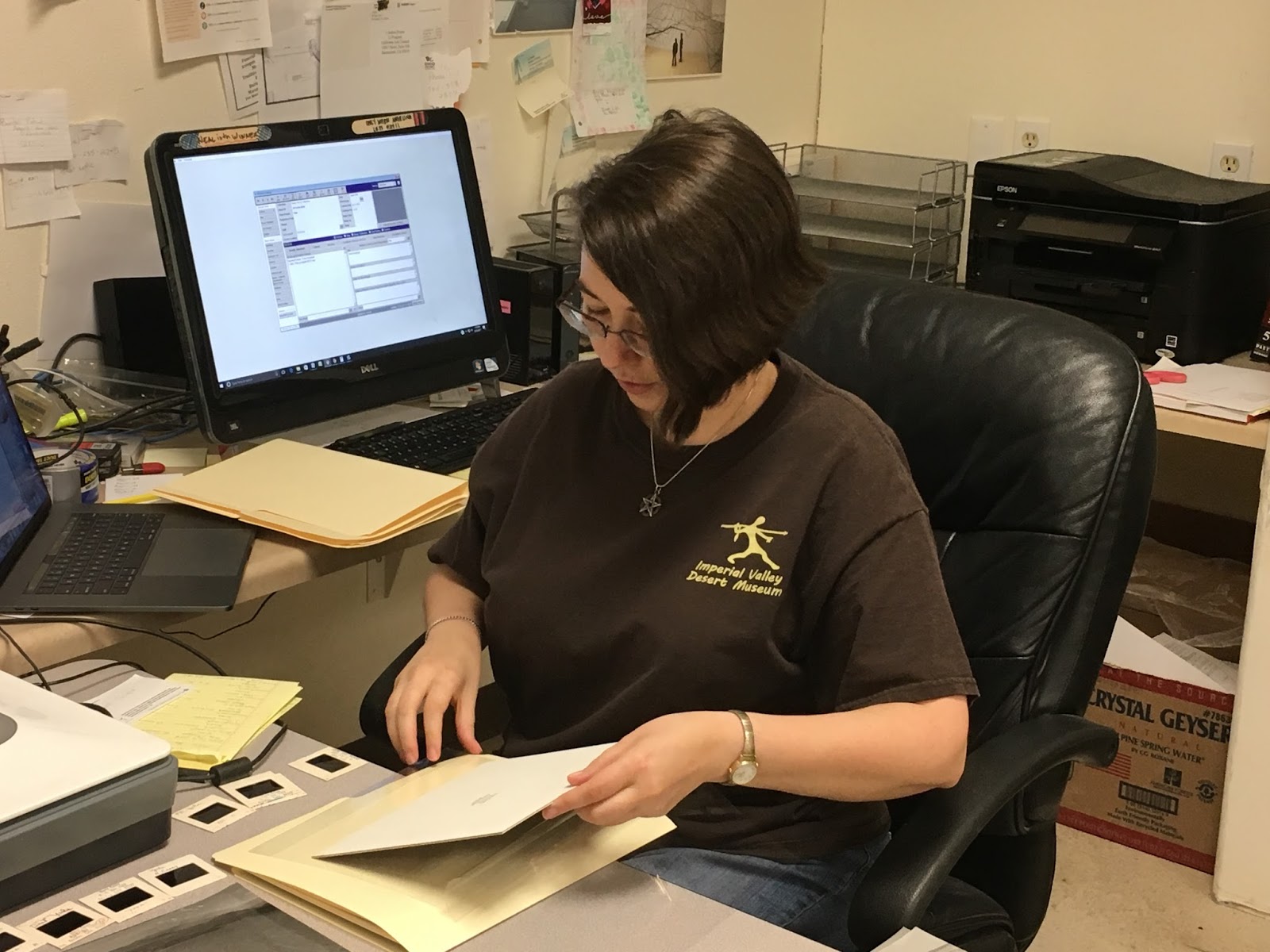
After spending several months on furlough, I have come back the the IVDM as an independent researcher. I could afford to stay for one month.  All I would be doing was itemizing, identifying, digitizing, and encapsulating images.

The Goal: to completely digitize the entire collection, including creating PastPerfect records for each image and a finding aid

Potential End Project Results: of course there'll be a finding aid and all the images will be digitized for researchers. But let's think bigger than that. How about a touchscreen tabletop computer with all the images loaded onto it, some cool graphics and text and suddenly any visitor can spend hours in the museum checking them out! A version of that as a webpage for people who can't come to the museum? Only imagination (and technology) are the limits!

Can this be done in a month without me going insane? Or at least done in a month, sanity a possible casualty to the cause?

Stay tuned and we'll find out!

Tuesday, September 27, 2016

Iteration, Iteration

Angelina Coble with new desert tortoise test panels
If there is one thing I've learned working with Neal Hitch these past few years it is "iteration, iteration, iteration".  Did something work? How can it work better?  What can you tweak to get more interaction?  Did something not work? Why not? What can you change?


This week I designed the second generation of our test sign panels to see what people wanted in outdoor signage. I took all of the comments and feedback we received from visitors on the original roadrunner panels and made a set of panels that took these comments into account, while still asking visitors to think of what it was they liked in different signs.  
Some comments were the same across the test signs: everyone liked the habitat range maps, the footprint examples (despite my bad artist's rendition!), and some of the fun facts.  While most people were leaning towards the flip signs by the end of the first test, it was still mixed enough that I decided to test both single panel and flip signs again to get a larger audience feedback.  


Angelina Coble writing sign prompt
The biggest thing that I changed was to include audience prompts.  Apparently it wasn't obvious enough in the first round of test panels that we wanted visitors to give their opinions of the signs, or certain features they liked best about the different signs, even though we seeded comments on each of the boards to act as prompts.  So, this time I wrote out specific questions on the top of each sheet.  The hope is that this will further prompt visitors to give the opinions I'm interested in, that will play into future sign design.  Hopefully it will also help people to understand that they are being given options to choose which they like best, something that seems to not have always been clear in the first round.  Even when docents explained the roadrunner signs and encouraged people to write down specifically what they liked, often they would simply put "I like this one best", leaving it up to us to guess what it was they liked about a particular test sign.  Visitors who toured the exhibits on their own seemed less likely to write on the panels, suggesting further prompting was needed to encourage people.

Prompt for visitor engagement
 These early test signs are certainly basic in many ways.  I'm no graphic designer, and personally I think it shows.  I've mounted the panels on cardboard and people will use basic sharpies to write their thoughts on paper.  But I don't think that early iterations are necessarily about sharp designer looks.  They are about engaging visitors in any way possible, and encouraging both staff, volunteers, and visitors to think about the content they want in a finished product.  And then taking those comments, sharpening the test product, and trying it again until you've got exactly what people want.


Saturday, September 10, 2016

Ceramic Re-housing Project

One side of IVDM's Visible Storage Exhibit. Local ceramic vessels
While there is probably no way to be completely "earthquake proof", we've been working to ensure that we minimize the risks to both our visitors and our collections.  Now that about half of the ceramics collection held here at the Imperial Valley Desert Museum are in a permanent Visible Storage exhibit, we can begin to re-house the remaining ollas.

When I came to the museum nearly four years ago, the collection of over 200 ceramic vessels (locally called "ollas") were all being held in a back storage room in climate controlled conditions.  The plan was to build an exhibit that would allow as many as possible to be put into an exhibit that would emphasize the importance of the vessels and ensure that the public benefitted from the collection through education and research.  The back storage room contains shelves bolted into the walls, each vessel was on a stand, and each shelf had barriers to prevent objects moving off the shelf in the event of an earthquake.
Gaylord archival fold-out box and padding

With almost half the collection now on display, this week we began a new project: putting the remaining ollas in safer housing.  We worked with Nancy Odegaard from Arizona State Museum and bought archival artifact boxes with slide-out trays and drop-out fronts.  Each of the smaller ceramic vessels would get a box, which would also be cushioned with non-reactive foam padding.

Edgar Bernal Sevilla applying label with photograph


Labels were made with not only information like the accession number, but also a photograph of the vessel.  Between images in the PastPerfect database and images on the labels, we are ensuring that minimal handling and moving of the artifacts will happen in the future.  Less handling and added cushioning increases the stability and safety of the vessels.  The boxes will also allow for more space-efficient storage, which will increase our artifact storage capacity as a whole.

Frank Salazar re-housing small ceramic 
Once back on the anchored shelves, shelf barriers are returned to cover the open sides of the shelf.  Until we can afford expensive shelving with fancy barriers or doors, this "poor museum's method" will increase the security and safety of those ceramics not on display.

New boxes on shelf, with labels, before shelf barriers. More space efficient & safer for ollas

The project is being done by myself; Frank J Salazar III, our Cultural Collections and Programs Manager; and staff member Angelina Coble.  Supplies for the project were funded through a National Endowment for the Humanities Preservation Assistance grant.